- My Forums
- Tiger Rant
- LSU Recruiting
- SEC Rant
- Saints Talk
- Pelicans Talk
- More Sports Board
- Fantasy Sports
- Golf Board
- Soccer Board
- O-T Lounge
- Tech Board
- Home/Garden Board
- Outdoor Board
- Health/Fitness Board
- Movie/TV Board
- Book Board
- Music Board
- Political Talk
- Money Talk
- Fark Board
- Gaming Board
- Travel Board
- Food/Drink Board
- Ticket Exchange
- TD Help Board
Customize My Forums- View All Forums
- Show Left Links
- Topic Sort Options
- Trending Topics
- Recent Topics
- Active Topics
Started By
Message
re: Storm Tracking Thread: Post Tropical Storm Hermine
Posted on 8/30/16 at 8:33 pm to GeauxTime9
Posted on 8/30/16 at 8:33 pm to GeauxTime9
quote:
Man, i just have this weird feeling that its coming for us. Something just tells me that all the models are wrong right now.
Not many examples of them agreeing this much and ultimately missing by 200 nautical miles (between Panama City on the western edge of the cone and Buras, LA) and 300 nautical miles between the center of the track and Buras. FWIW, @ 48 hours the average margin of error for tropical depressions is still less than 100 nautical miles, so while nothing is a certainty, things are looking peachy for LA.

For a system that is basically in the middle of the GOM, that is about as good as you can conceivably hope for unless it completely dissipates.
 3
3

Posted on 8/30/16 at 8:35 pm to burdman
NHC is usually pretty good 3 days in. This is a Florida storm folks.

Posted on 8/30/16 at 8:35 pm to slackster
It's coming our way baw. :dwi:
Posted on 8/30/16 at 8:38 pm to slackster
quote:. Which is why I don't trust it at all. When was the last time a system spent 3 days in the middle of the gulf and didn't become a dangerous storm? I'm asking because I don't remember one ever just dissipating after being in the gulf that long.
For a system that is basically in the middle of the GOM, that is about as good as you can conceivably hope for
Posted on 8/30/16 at 8:40 pm to theunknownknight
quote:
It's coming our way baw. :dwi:
Posted on 8/30/16 at 8:40 pm to Bestbank Tiger
quote:
That's current/immediate past vs. future motion.
The next dot is 12 hours from now.
Also, they don't update path on updates and only with issuing full packages, so the path can look squirrelly in between. Then add in that they smooth the track and don't make drastic changes.
Posted on 8/30/16 at 8:44 pm to OldSouth
quote:
Which is why I don't trust it at all. When was the last time a system spent 3 days in the middle of the gulf and didn't become a dangerous storm? I'm asking because I don't remember one ever just dissipating after being in the gulf that long.
Karen from 2013?
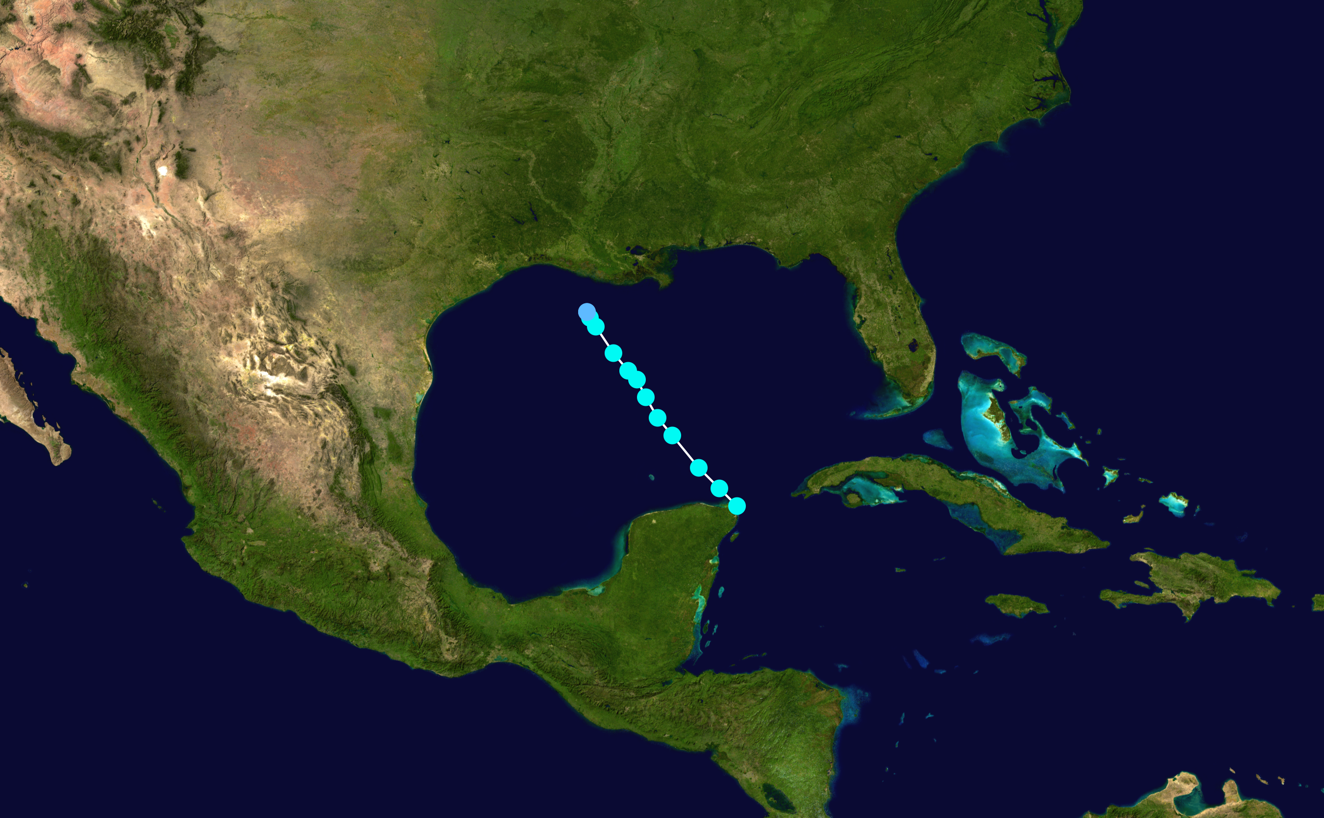
The absence of storms in the GOM lately is pretty well documented. Shear has been a major issue and is still forecast to be an issue as this system moves northward.
Posted on 8/30/16 at 8:46 pm to slackster
I hope your right. I just thought that the warm waters trumped almost everything's else.
Posted on 8/30/16 at 8:48 pm to rds dc
The initial big flare up of convection seems to be giving way to a northeastern flare up. Somewhere in between and to the northwest is where the LLC appeared last before dusk.

Posted on 8/30/16 at 8:50 pm to OldSouth
quote:
I hope your right. I just thought that the warm waters trumped almost everything's else.
Yeah I mean they're a piece of the puzzle but it takes a lot more than that alone. Karen literally dissipated going across the GOM.
Posted on 8/30/16 at 8:52 pm to OldSouth
quote:
I hope your right. I just thought that the warm waters trumped almost everything's else.
Mid levels up in the atmosphere trump everything, IMO. There has been plenty of warm water the past few years. Some of the best looking Atlantic storms lately have been farther north over cooler waters, see Gaston.
Posted on 8/30/16 at 8:54 pm to rds dc
I don't know if this storm will amount to anything, but this is probably the "best" it has looked on IR since the thread was started.
Posted on 8/30/16 at 8:59 pm to lsuman25
quote:
A very confusing storm
I am just checking to see what's going on with this storm. I was talking with my neighbor earlier and he said it looks like it will hook East, but reading in this thread it looks like there other factors involved that is making this storm not easy to predict.
Posted on 8/30/16 at 9:00 pm to slackster
Really depends on where the LLC is but it's firing plenty of convection tonight.


Posted on 8/30/16 at 9:02 pm to rds dc
Its been a tough little storm. I know its illogical at this point but I still don't trust the models,at least not until it is a little more organized. It's been a mess. The latest infrared images look like it may be trying to get its shite together.
This post was edited on 8/30/16 at 9:03 pm
Posted on 8/30/16 at 9:05 pm to rds dc
I'm not sure how much of the convection to the east is considered part of the system, but size wise this thing is quite large at the moment.
Posted on 8/30/16 at 9:07 pm to OweO
quote:
I was talking with my neighbor earlier and he said it looks like it will hook East, but reading in this thread it looks like there other factors involved that is making this storm not easy to predict.
In the end, all models agree that the trough will be deep enough to capture the storm. I would only be a little nervous if I lived in Destin or Panama City

Posted on 8/30/16 at 9:08 pm to slackster
This is probably a stupid question and/or has been discussed, but I bet there's a good number of LSU fans flying through ATL on Thursday/Friday.....are we thinking this is going to mess up some travel plans?
Posted on 8/30/16 at 9:11 pm to OldSouth
I wouldn't be worried at all about Louisiana. I'm only paying attention to see if I'm going to be sitting in the rain all weekend at the beach.
Posted on 8/30/16 at 9:11 pm to Shankopotomus
No.
Probably not.
Maybe?
Probably not.
Maybe?
This post was edited on 8/30/16 at 9:13 pm

 Page 151 of 175

Popular
Back to top