- My Forums
- Tiger Rant
- LSU Recruiting
- SEC Rant
- Saints Talk
- Pelicans Talk
- More Sports Board
- Winter Olympics
- Fantasy Sports
- Golf Board
- Soccer Board
- O-T Lounge
- Tech Board
- Home/Garden Board
- Outdoor Board
- Health/Fitness Board
- Movie/TV Board
- Book Board
- Music Board
- Political Talk
- Money Talk
- Fark Board
- Gaming Board
- Travel Board
- Food/Drink Board
- Ticket Exchange
- TD Help Board
Customize My Forums- View All Forums
- Show Left Links
- Topic Sort Options
- Trending Topics
- Recent Topics
- Active Topics
Started By
Message
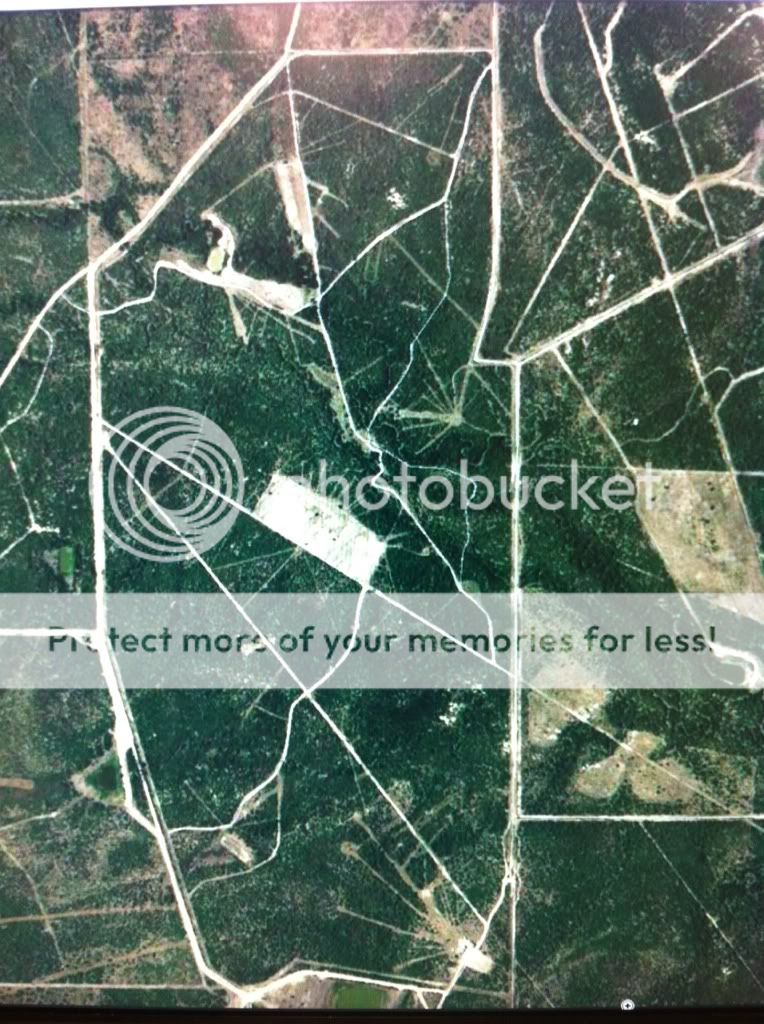
Aerial Map for Hunting Club
Posted on 10/29/15 at 1:18 pm
Posted on 10/29/15 at 1:18 pm
I remember a poster on here who was in the aerial mapping business, anyone have a contact for him or if he sees this hit me up
<---- @ gmail.com
<---- @ gmail.com
 12
12


Posted on 10/29/15 at 1:31 pm to Tbooux
MeauxJeaux2 I believe 
Posted on 10/29/15 at 1:35 pm to Polar Pop
Terraserver.com

Posted on 10/29/15 at 1:39 pm to Polar Pop
quote:
MeauxJeaux2 I believe
Yup pretty sure thats him

Posted on 10/29/15 at 1:48 pm to Tbooux
Huntera Maps 
Posted on 10/29/15 at 2:15 pm to Tbooux
I have his personal email, but not sure he'd want me to give it out. I'll send him one later though
This post was edited on 10/29/15 at 2:16 pm
Posted on 10/29/15 at 2:58 pm to Tbooux
How much more detailed are these professional maps vs. Google Earth? I'm sure you could screenshot your lease on google and take it to kinkos to be enlarged for little to nothing.
Is it better quality?
Is it better quality?
Posted on 10/29/15 at 3:03 pm to SportTiger1
They have an account with Google and maybe Bing and can print out better maps than normal people can. They can also get a plane up if you've got the cash
Eta: By better maps, I mean they have the original images. If you took a screenshot of your computer and blew that up, the resolution would go to shite the bigger you made it. They size get the size poster you want, zoom to include the whole property, and print that
Eta: By better maps, I mean they have the original images. If you took a screenshot of your computer and blew that up, the resolution would go to shite the bigger you made it. They size get the size poster you want, zoom to include the whole property, and print that
This post was edited on 10/29/15 at 3:10 pm

Posted on 10/29/15 at 3:12 pm to Tbooux
I just texted MJ2 him for you
ETA: he's banned. his email is meauxjeaux2@yahoo.com
ETA: he's banned. his email is meauxjeaux2@yahoo.com
This post was edited on 10/29/15 at 3:30 pm
Posted on 10/29/15 at 3:52 pm to Tbooux
I just ordered one on Hunterra. Quick and easy, my dad will love it for his place.
Posted on 10/29/15 at 3:57 pm to slinger1317
depending on how large your place actually is I'd be willing to bring the drone out and get some pictures for you.
Posted on 10/29/15 at 4:30 pm to purpleguy2
Thanks guys, will check out hunterra and shot MJ2 and email as well.
Purpleguy2, its over 2000 acres so would take a pretty extensive drone flight. lol.
Purpleguy2, its over 2000 acres so would take a pretty extensive drone flight. lol.
Posted on 10/29/15 at 4:41 pm to Polar Pop
i hope whoever downvoted me chokes on a dick halloween night
Posted on 10/29/15 at 6:56 pm to Tbooux
our club used google earth. printed it, enlarged copies, laminated it and use it to mark stands at our sign-in desk. piece of cake.
Posted on 10/29/15 at 6:56 pm to Tbooux
A buddy who's a landman got us a print and digit of our place. Pretty sure if you know one they have access to high quality aerials.
This post was edited on 10/29/15 at 6:57 pm
Posted on 10/29/15 at 10:53 pm to Tbooux
I get custom topo maps from my topo.com.
I think you can get aerial also but not sure on quality of those. The topos are great for hiking which I what I use them for.
Just another option.
I think you can get aerial also but not sure on quality of those. The topos are great for hiking which I what I use them for.
Just another option.
Posted on 10/30/15 at 6:41 am to 4WHLN
quote:
MeauxJeaux2 I believe
This guy. I got him to do one for our club a couple years ago. Really nice map.
Posted on 10/30/15 at 7:29 am to Tbooux
Are you wanting just aerial imagery or are you wanting to mark roads, stands, and plots as well?
Posted on 10/30/15 at 8:47 am to Kashmir
I use GE Pro for mapping boundaries and roads and stands/plots/features.
I also use it to range certain landmarks for stands with shots 150 yds+. I print those maps for each stand and then laminate it and put it in the stand. Saves needing to range everything.
I also use it to range certain landmarks for stands with shots 150 yds+. I print those maps for each stand and then laminate it and put it in the stand. Saves needing to range everything.

 Page 1 of 1


Popular
Back to top