- My Forums
- Tiger Rant
- LSU Recruiting
- SEC Rant
- Saints Talk
- Pelicans Talk
- More Sports Board
- Winter Olympics
- Fantasy Sports
- Golf Board
- Soccer Board
- O-T Lounge
- Tech Board
- Home/Garden Board
- Outdoor Board
- Health/Fitness Board
- Movie/TV Board
- Book Board
- Music Board
- Political Talk
- Money Talk
- Fark Board
- Gaming Board
- Travel Board
- Food/Drink Board
- Ticket Exchange
- TD Help Board
Customize My Forums- View All Forums
- Show Left Links
- Topic Sort Options
- Trending Topics
- Recent Topics
- Active Topics
Started By
Message
re: Danny - no longer a threat
Posted on 8/20/15 at 5:49 pm to baytiger
Posted on 8/20/15 at 5:49 pm to baytiger
quote:
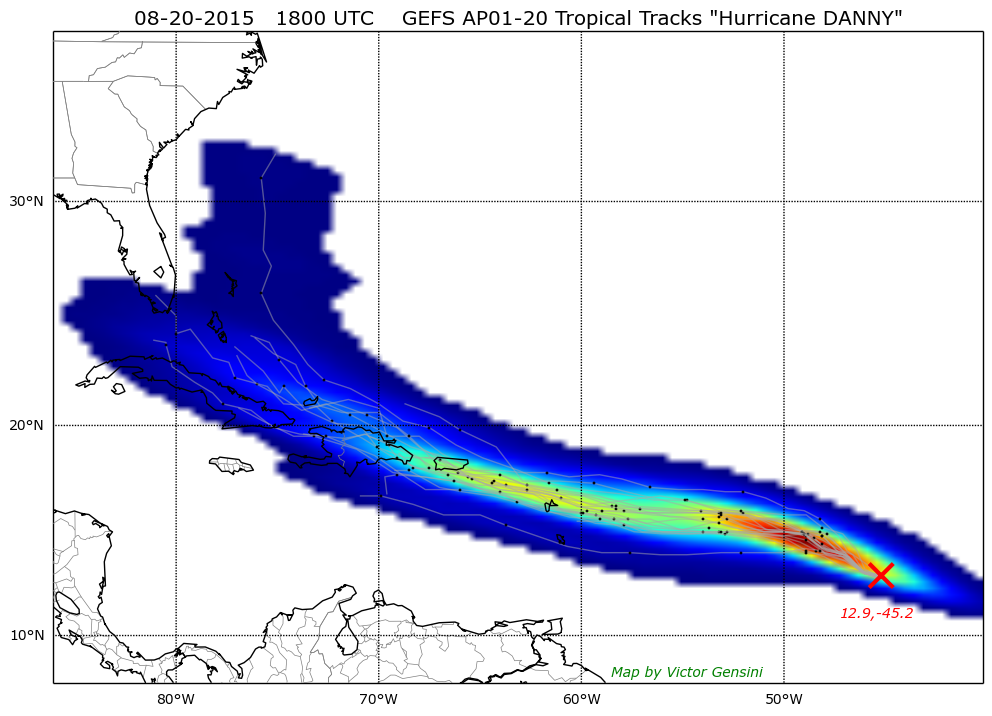
t actually has the shear intensifying as Danny approaches. Poor guy doesn't have a chance.
It will be interesting to see what kind of a run Danny makes tonight. It looks like maybe 24 hrs or so before shear starts to ramp up and conditions go down hill. Even if it could some how survive the models are pretty locked in on an expanding H5 ridge and a ULL to the N. Then the Caribbean is a wasteland with increasing background flow. Then beyond that, the models cutoff a huge ULL over the northern Gulf shearing the whole entire Gulf out. There is no safe passage for Danny.
Maybe future 98L will be worthy of a 10+ page thread
ETA: make that 20+ pages
This post was edited on 8/20/15 at 5:50 pm
 1
1

Posted on 8/20/15 at 5:49 pm to CuseTiger
quote:
past miami across florida then straight to nola
Great, that gets me and an old friend, have a down vote.

Posted on 8/20/15 at 5:57 pm to rds dc
quote:
Maybe future 98L will be worthy of a 10+ page thread
Perhaps it can succeed where Danny failed
Posted on 8/20/15 at 6:00 pm to TDsngumbo
Jacksonville is due. They have no idea what a hurricane is besides the wing place
Posted on 8/20/15 at 6:18 pm to baytiger
quote:
Perhaps it can succeed where Danny failed
The Pacific typhoons are about to blow up the high lats with model insanity to follow. We should see every possible solution with wild changes each cycle. It should be entertaining for anyone who isn't issuing a forecast
Posted on 8/20/15 at 6:36 pm to rds dc
Luckily I don't have any forecasts anywhere near any of these storms

Posted on 8/20/15 at 7:33 pm to JAXTiger16
quote:
Jacksonville is due. They have no idea what a hurricane is besides the wing place
The north east Florida coast never gets hurricane threats. I've had family living in Neptune Beach for 50 years and I only remember them evacuate once several years ago, and I don't think the storm came close.
Posted on 8/20/15 at 9:58 pm to baytiger
quote:
still waiting on a model to throw it out in the atlantic
any model now

Posted on 8/20/15 at 10:13 pm to baytiger
quote:
eta: looking at our internal model... it actually has the shear intensifying as Danny approaches. Poor guy doesn't have a chance.
Though Danny got his act together today. Pretty decent looking for now considering how bad it was last night.
Posted on 8/20/15 at 10:13 pm to Placebeaux
Posted on 8/20/15 at 10:13 pm to rds dc
Posted on 8/20/15 at 10:38 pm to The Boat
quote:
Though Danny got his act together today. Pretty decent looking for now considering how bad it was last night.
Yeah, not too shabby tonight

Posted on 8/20/15 at 10:41 pm to rds dc
I'm interested in seeing the next full advisory. 80 mph 990 mb storms don't look like that.

Posted on 8/20/15 at 10:45 pm to rds dc
quote:
Yeah, not too shabby tonight
Typical nighttime blow up.

Posted on 8/20/15 at 10:46 pm to GEAUXmedic
When's this shear supposed to come into play? I keep seeing the past couple nights "the next 24 hours could be real interesting"
Posted on 8/20/15 at 10:57 pm to tunechi
quote:Not until it gets to the Antilles/Puerto Rico
When's this shear supposed to come into play? I keep seeing the past couple nights "the next 24 hours could be real interesting"
Posted on 8/20/15 at 11:20 pm to baytiger
You think it holds off that long? I was thinking closer to 50W. Too bad there isn't recon out tonight b/c Danny is going gang busters.
Posted on 8/20/15 at 11:43 pm to rds dc
quote:
You think it holds off that long? I was thinking closer to 50W. Too bad there isn't recon out tonight b/c Danny is going gang busters.
Well, recon is out there, just not in the storm, they headed out there earlier today to get closer for tomorrow. I think it has a good chance at getting through the shear, and if it goes north/south of the islands after hitting puerto rico it'll have a chance.
Posted on 8/21/15 at 12:39 am to rds dc
I think it'll start getting sheared apart by 55 and become an unrecognizable mess in the antilles and then open wave over puerto rico
in other news, NHC just put an X on 98L
in other news, NHC just put an X on 98L

Posted on 8/21/15 at 12:43 am to baytiger
quote:
I think it'll start getting sheared apart by 55 and become an unrecognizable mess in the antilles and then open wave over puerto rico
This.............

 Page 20 of 30

Popular
Back to top