- My Forums
- Tiger Rant
- LSU Recruiting
- SEC Rant
- Saints Talk
- Pelicans Talk
- More Sports Board
- Winter Olympics
- Fantasy Sports
- Golf Board
- Soccer Board
- O-T Lounge
- Tech Board
- Home/Garden Board
- Outdoor Board
- Health/Fitness Board
- Movie/TV Board
- Book Board
- Music Board
- Political Talk
- Money Talk
- Fark Board
- Gaming Board
- Travel Board
- Food/Drink Board
- Ticket Exchange
- TD Help Board
Customize My Forums- View All Forums
- Show Left Links
- Topic Sort Options
- Trending Topics
- Recent Topics
- Active Topics
Started By
Message
re: Hurricane Irma - Spinning Down
Posted on 9/2/17 at 4:24 am to CCT

Posted on 9/2/17 at 4:24 am to CCT
Remember how 2 days ago when it was aimed to the Gulf everyone was saying the models are too far out to be accurate and to wait til we're closer.
It's the same thing now that the models say we are in the clear. Just cause it gives us a favorable outcome doesn't mean it's more accurate. That is the definition of wishcasting.
We just have to be patient.
It's the same thing now that the models say we are in the clear. Just cause it gives us a favorable outcome doesn't mean it's more accurate. That is the definition of wishcasting.
We just have to be patient.
 1
1


Posted on 9/2/17 at 6:53 am to GEAUXmedic
quote:
LINK ]Why the Hurricane Irma Forecast for the U.S. Is Still Uncertain and Difficult | The Weather Channel

The example below features, in gray, the ensemble forecast tracks from the European Centre for Medium-Range Weather Forecasts, conducted Aug. 31 at 8 p.m. EDT. You can hardly see the U.S. map below the mess of possible tracks, extending from south of Newfoundland to the Gulf of Mexico.
The second part of the animation shows another set of ensemble forecast tracks – this time in blue – from NOAA.

So, how's your forecast confidence now? Mine, frankly, is very low. There are surely a number of ominous tracks, but many also curl Irma out to sea away from the East Coast.
This kind of uncertainty is very common with hurricanes thousands of miles and more than a week away from the U.S.
Professional meteorologists don't analyze one particular run of one model, but look at an entire suite of current data – such as those from satellites as well as ensemble models – learn each model's biases and, importantly, look for trends in those models over time to help diagnose the danger of any hurricane to the East Coast.
All we can say right now is that the U.S. East Coast and Gulf Coast all need to monitor the progress of Irma.
This post was edited on 9/2/17 at 6:56 am
Posted on 9/2/17 at 7:17 am to CCT
quote:
There's a U2 concert in NOLA on the 14th, too. shite.
Great. Now God has to send it to Louisiana.

Posted on 9/2/17 at 7:19 am to cajunangelle

Posted on 9/2/17 at 7:51 am to Ba Ba Boooey
quote:
Yea it's still a while away but that jump north into a strong ridge is odd We will see what the next few runs show
Yea I would have thought if it misses the trough it would go into the gulf
Posted on 9/2/17 at 8:34 am to rt3
What's that lowest pressure estimate in the center?
Posted on 9/2/17 at 8:55 am to rds dc
Irma is making the turn to the SW. How far SW does it go?


Posted on 9/2/17 at 9:05 am to rds dc
Getting closer to that annular status, too... 
Posted on 9/2/17 at 9:16 am to Hulkklogan
the 06z GFS this AM... essentially the same landfall spot as the 00z GFS

This post was edited on 9/2/17 at 9:19 am
Posted on 9/2/17 at 9:20 am to Hulkklogan
quote:
Getting closer to that annular status, too...
The current Annular Hurricane Index is 0 with 100 being best fit annular.
Posted on 9/2/17 at 9:23 am to rds dc
ok i'll shut up.
This post was edited on 9/2/17 at 9:29 am
Posted on 9/2/17 at 9:25 am to Hulkklogan
quote:
ok i'll shut up.
Posted on 9/2/17 at 9:29 am to rds dc
quote:
Getting closer to that annular status, too...
The current Annular Hurricane Index is 0 with 100 being best fit annular.
0 is only 100 away from 100.
Posted on 9/2/17 at 9:30 am to East Coast Band
quote:
0 is only 100 away from 100.
You got to start somewhere!
Posted on 9/2/17 at 9:31 am to East Coast Band
I literally couldn't be more wrong 
Posted on 9/2/17 at 9:35 am to Hulkklogan
I'm not sure where you can find the current index rating, but this is something I found while looking for it:
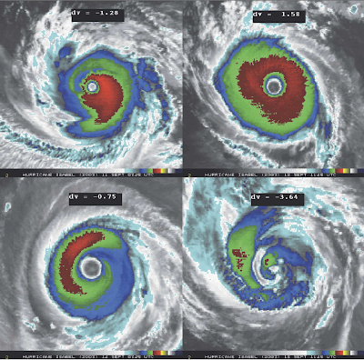
Values greater than 0 indicate an annular hurricane, so basically only the top right.
Values greater than 0 indicate an annular hurricane, so basically only the top right.
Posted on 9/2/17 at 9:38 am to slackster
quote:
I'm not sure where you can find the current index rating, but this is something I found while looking for it:
## ANNULAR HURRICANE INDEX (AHI) AL112017 IRMA 09/02/17 12 UTC ##
## STORM NOT ANNULAR, SCREENING STEP FAILED, NPASS=5 NFAIL=2 ##
## AHI= 0 (AHI OF 100 IS BEST FIT TO ANN. STRUC., 1 IS MARGINAL, 0 IS NOT ANNULAR) ##
ETA: It's in the SHIPS text file LINK
This post was edited on 9/2/17 at 9:43 am
Posted on 9/2/17 at 9:54 am to rds dc
Thanks.
Posted on 9/2/17 at 9:57 am to rds dc
12z early tracks, 15N,55W is kind of the benchmark that I'm watching for the SW dive that would start to raise some concerns, nothing really close.

Posted on 9/2/17 at 10:04 am to rds dc
When is Irma supposed to hit Cat 4 status?

 Page 34 of 711

Popular
Back to top