- My Forums
- Tiger Rant
- LSU Recruiting
- SEC Rant
- Saints Talk
- Pelicans Talk
- More Sports Board
- Winter Olympics
- Fantasy Sports
- Golf Board
- Soccer Board
- O-T Lounge
- Tech Board
- Home/Garden Board
- Outdoor Board
- Health/Fitness Board
- Movie/TV Board
- Book Board
- Music Board
- Political Talk
- Money Talk
- Fark Board
- Gaming Board
- Travel Board
- Food/Drink Board
- Ticket Exchange
- TD Help Board
Customize My Forums- View All Forums
- Show Left Links
- Topic Sort Options
- Trending Topics
- Recent Topics
- Active Topics
Started By
Message
re: Tornado! Threat Shifting East
Posted on 4/14/18 at 8:10 am to Chatagnier

Posted on 4/14/18 at 8:10 am to Chatagnier
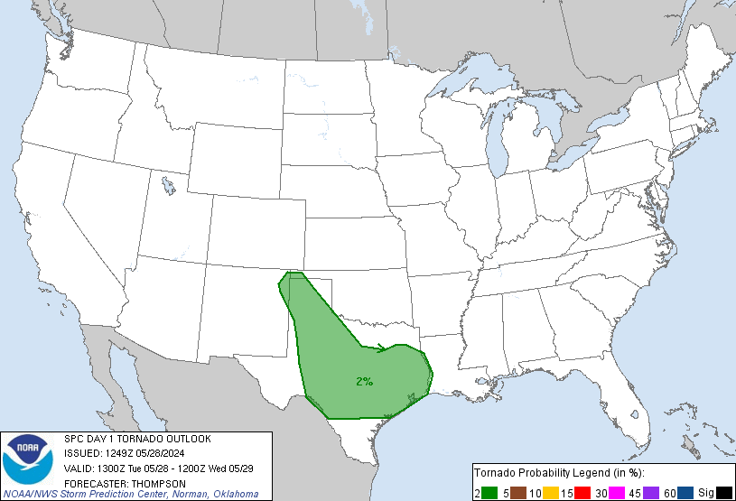
SPC took the hatched area out of the tornado probabilities.
 4
4

Posted on 4/14/18 at 8:12 am to Roll Tide Ravens
Where is this tornado?

Posted on 4/14/18 at 8:14 am to Roll Tide Ravens
Jeff Morrow keeps flipping to different screens and implying that people are stupid and won’t get what he’s looking at but just deal with it because it’s more for him to see than you.
Posted on 4/14/18 at 8:14 am to msutiger
quote:
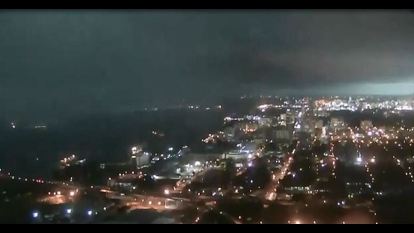
Holy crap we are about to get skull fricked in BR looking at the radar
No way. This is about to be very under-whelming.

Posted on 4/14/18 at 8:14 am to The Boat
The shite we got around 7 am looked like the apocalypse.
Posted on 4/14/18 at 8:15 am to DeafJam73
Current tornado warned area is for the Baker/Zachary area I believe.
Posted on 4/14/18 at 8:15 am to The Boat
Coursey near Stumberg getting hammered.

Posted on 4/14/18 at 8:16 am to DeafJam73
quote:
Where is this tornado?
Near Baker moving NE.
The tornado warning is what woke me up and I planned to sleep in. Motherfrickers.
Posted on 4/14/18 at 8:17 am to The Boat
I can’t believe they couldn’t get Jay Grymes out of bed for this. This Morrow guy is horrible
Posted on 4/14/18 at 8:18 am to hendersonshands
quote:
The shite we got around 7 am looked like the apocalypse.
It looks similar on the radar but so far this is nothing close to the end of the world line of storms we got that morning in April of 2015.
Posted on 4/14/18 at 8:19 am to OldManRiver
quote:
I can’t believe they couldn’t get Jay Grymes out of bed for this. This Morrow guy is horrible
I’m not worried since Jay isn’t on TV. If I woke up to a tornado warning with Jay on TV in jeans and his sleeves rolled up I’d know we were fricked.
Posted on 4/14/18 at 8:21 am to The Boat
quote:
I’m not worried since Jay isn’t on TV. If I woke up to a tornado warning with Jay on TV in jeans and his sleeves rolled up I’d know we were fricked.
This post was edited on 4/14/18 at 8:22 am

Posted on 4/14/18 at 8:21 am to TigerstuckinMS
Tornado warning just issued for Ascension Parish or at least where I live in Ascension Parish.
Posted on 4/14/18 at 8:21 am to Tigerbait357
Winds in central are crazy. Getting hammered right now.
Posted on 4/14/18 at 8:21 am to Tigerbait357
Charcoal colored jeans at that.
Posted on 4/14/18 at 8:22 am to The Boat
quote:
It looks similar on the radar but so far this is nothing close to the end of the world line of storms we got that morning in April of 2015.
Yeah, that derecho was nuts.
Middle of the morning, like 9-10 AM middle, in Baton Rouge April 27, 2018.

Posted on 4/14/18 at 8:22 am to Roll Tide Ravens
So my untrained eye looking at the radar it looks like Nola will miss the worst of it and basically get clipped by the tail end?

Posted on 4/14/18 at 8:22 am to The Boat
Power has been out over here close to LSU since 8. Still blowing/raining hard. First big gusts of wind took out the power. Entergy FTW
Posted on 4/14/18 at 8:22 am to WhoGeaux
Jeff Morrow with a “Bishop Sullivan” shoutout.
Posted on 4/14/18 at 8:22 am to Roll Tide Ravens
BULLETIN - EAS ACTIVATION REQUESTED
Tornado Warning
National Weather Service New Orleans LA
818 AM CDT SAT APR 14 2018
The National Weather Service in New Orleans has issued a
* Tornado Warning for...
Northwestern Ascension Parish in southeastern Louisiana...
Central Livingston Parish in southeastern Louisiana...
Southwestern Tangipahoa Parish in southeastern Louisiana...
South central East Baton Rouge Parish in southeastern Louisiana...
* Until 900 AM CDT.
* At 818 AM CDT, a severe thunderstorm capable of producing a tornado
was located over Old Jefferson, or 7 miles south of Denham Springs,
moving east at 45 mph.
HAZARD...Tornado.
SOURCE...Radar indicated rotation.
IMPACT...Flying debris will be dangerous to those caught without
shelter. Mobile homes will be damaged or destroyed.
Damage to roofs, windows, and vehicles will occur. Tree
damage is likely.
* This dangerous storm will be near...
French Settlement and Port Vincent around 830 AM CDT.
Livingston around 835 AM CDT.
Whitehall around 840 AM CDT.
Albany around 850 AM CDT.
Springfield around 855 AM CDT.
Ponchatoula around 900 AM CDT.
Other locations impacted by this tornadic thunderstorm include
Killian.

 Page 14 of 24

Popular
Back to top