- My Forums
- Tiger Rant
- LSU Recruiting
- SEC Rant
- Saints Talk
- Pelicans Talk
- More Sports Board
- Winter Olympics
- Fantasy Sports
- Golf Board
- Soccer Board
- O-T Lounge
- Tech Board
- Home/Garden Board
- Outdoor Board
- Health/Fitness Board
- Movie/TV Board
- Book Board
- Music Board
- Political Talk
- Money Talk
- Fark Board
- Gaming Board
- Travel Board
- Food/Drink Board
- Ticket Exchange
- TD Help Board
Customize My Forums- View All Forums
- Show Left Links
- Topic Sort Options
- Trending Topics
- Recent Topics
- Active Topics
Started By
Message
 1
1


Posted on 8/17/15 at 11:41 am to lsuhunt555
quote:
So when might it show up if it were to come to LA?
At least a week and a half. At least.

Posted on 8/17/15 at 3:33 pm to TDsngumbo
Euro is on board. even goes as far as keeping it together south of Haiti. It's looking more organized at the moment, NHC should bump up the probabilities tonight, if we don't have a TD by then. HWRF still has it at ~ 88mph and ~970 mb, UKMET now has it going north of the island then curving back west.
Posted on 8/17/15 at 3:39 pm to SippyCup
quote:
quote:
IF it were probably mid to late next week.
Probably wont even be in the Caribbean next week.
it's at least 10 days from the Caribbean Sea

Posted on 8/17/15 at 3:54 pm to tgrbaitn08
im dumb ignore me 

Posted on 8/17/15 at 4:25 pm to Motorboat
Posted on 8/17/15 at 10:11 pm to GEAUXmedic
quote:
Euro is on board. even goes as far as keeping it together south of Haiti. It's looking more organized at the moment, NHC should bump up the probabilities tonight, if we don't have a TD by then. HWRF still has it at ~ 88mph and ~970 mb, UKMET now has it going north of the island then curving back west.
I don't have a lot of confidence in the Euro at this point and would like to see some consistency and significant support from the ensembles, the 00z run had nothing. However, the evolution on the 12z Euro is more believable than the GFS solution. The GFS hardly moves 96L from Wednesday to Saturday and just has it festering in the ITCZ.
There is a pretty larger SAL outbreak just to the north of 96L and that is typically bad news. However, if 96L can stay south then it has a window to develop. I mentioned in the other thread that the best chance for development was to stay as far S as possible and that is still true.

The SAL combo of shear, dry air and stable atmosphere can be a real killer. However, 96L is currently S of the African Easterly Jet (AEJ) that is associated with the SAL outbreak. The AEJ is stronger than the background easterlies and this acts to increase cyclonic vortcity (helps spin things up) and the area S is currently experiencing less shear.
Another benefit of staying S is that 96L could be more influenced by the passing KW. The influence of KW fades as you head away from the equator.

The KW could be enough to offset the overall background state of a mostly stable suppressed MDR and Caribbean. The ITCZ obviously stands out and overall things aren't as bad as they have been but still more stable than normal.

Anyway, this has a bit of a window to do something and convection look pretty good tonight.
This post was edited on 8/17/15 at 10:14 pm
Posted on 8/17/15 at 10:17 pm to TDsngumbo
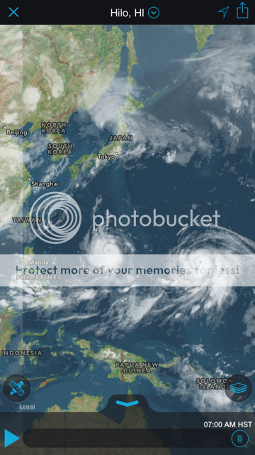
Meh. I'd be more worried if I lived in the Philippines or in Taiwan. To say the least.

Posted on 8/17/15 at 11:09 pm to Mullet Flap
Latest ECMWF (12Z 8/17) and GFS (00Z 8/18) are both pointing this thing at the Caribbean... at least the GFS is hinting at it 114 hours out. Model hasn't finished running yet.
This post was edited on 8/17/15 at 11:12 pm
Posted on 8/17/15 at 11:10 pm to rds dc
quote:
There is a pretty larger SAL outbreak just to the north of 96L and that is typically bad news. However, if 96L can stay south then it has a window to develop. I mentioned in the other thread that the best chance for development was to stay as far S as possible and that is still true.
Every model is keeping it south, too.

Posted on 8/18/15 at 5:56 am to TDsngumbo
this is all we need now

Posted on 8/18/15 at 6:22 am to TDsngumbo
Dammit I am in the lesser antilles. I am catching a flight back to the USA for 2 weeks on thursday. This thing better not mess up my plans, I need to get off this damn island for awhile.

Posted on 8/18/15 at 6:43 am to WeeWee
Some of you guys sound like yall want it to form.
Posted on 8/18/15 at 6:44 am to Ray Finkle
Of course they do
Posted on 8/18/15 at 6:45 am to Ray Finkle
quote:
by Ray Finkle
Some of you guys sound like yall want it to form.
They do. They wish for it so bad then when it doesnt happen they get all pissy. They will copy and paste until they can't copy and paste no more.
Posted on 8/18/15 at 6:48 am to tgrbaitn08
Id love for it to form and sit out in the atlantic. Im taking a tropical meteorology class this semester and would love to have something to look at.
Posted on 8/18/15 at 6:48 am to baytiger
quote:
Latest ECMWF (12Z 8/17) and GFS (00Z 8/18) are both pointing this thing at the Caribbean... at least the GFS is hinting at it 114 hours out. Model hasn't finished running yet.
Good. I will be back in warm embracing breasts of mother liberty and father don't get food poisoning every other damn day, by then and any damage should be cleaned up by the time I get back.
Posted on 8/18/15 at 6:50 am to rds dc
quote:
rds dc
It sounds like you want this to form...
Posted on 8/18/15 at 6:56 am to Pedro
its 1725 miles east-southeast of Barbados.
and...
and...
quote:
Some of the model data suggest that the system could maintain tropical storm intensity by the time it reaches the Lesser Antilles in about 7 days. However, the system may succumb to the dry air to its north. There also remains plenty of wind shear over the Caribbean. Therefore, the system may weaken substantially before reaching the Caribbean.

 Page 2 of 30

Popular
Back to top